Mount Zao straddles the border between Miyagi and Yamagata Prefectures. It and the surrounding highlands are an area of seasonally-changing beauty shaped by ancient volcanic activity. It is a popular destination for hiking, cycling, and scenic drives, particularly in autumn when the fall colors are at their peak. The best way take in the natural beauty from the road is by cycling the Zao Echo Line . . . if you’ve got the stamina for it.
The Zao Echo Line is the name given to the most scenic, highest elevation portion of Highway 12, a 26-kilometer stretch traversing the mountainous border between Miyagi and Yamagata prefectures. It winds through the highlands and climbs most of the way up Mount Zao, Miyagi’s tallest mountain. This ride goes up and over Mount Zao and down the other side, eventually winding up at Kaminoyama Onsen in Yamagata. On the way, riders can take in waterfalls, spiritual sites, and rocky highland vistas. Riders can even take in Okama Crater, the crown jewel of Zao, via a short chair lift ride or hike.
Course Details
Though the route isn’t especially long, the steady 35-kilometer climb to the 1606-meter-high Togatta Pass makes it one not for the faint of heart . . . or lung. To cover the change in elevation manageably, the highway hits a 10% grade just beyond Togatta Onsen and hovers around that until it reaches the rocky highlands—kudos to the engineer who designed it.
From Shiroishi Station, follow Highway 457 to Togatta Onsen. Stop in Togatta Onsen to fuel up for the climb (I recommend the tofu ice cream or sankakuage at Tofu Shop Hasegawaya). Beyond Togatta Onsen, it’s essentially wilderness until you crest the pass and descend a good ways into Yamagata. The few food or drink stops on the climb up have hours too unpredictable to be counted upon, and you won’t see another convenience store until you hit Kaminoyama Onsen at the tail end of the ride.
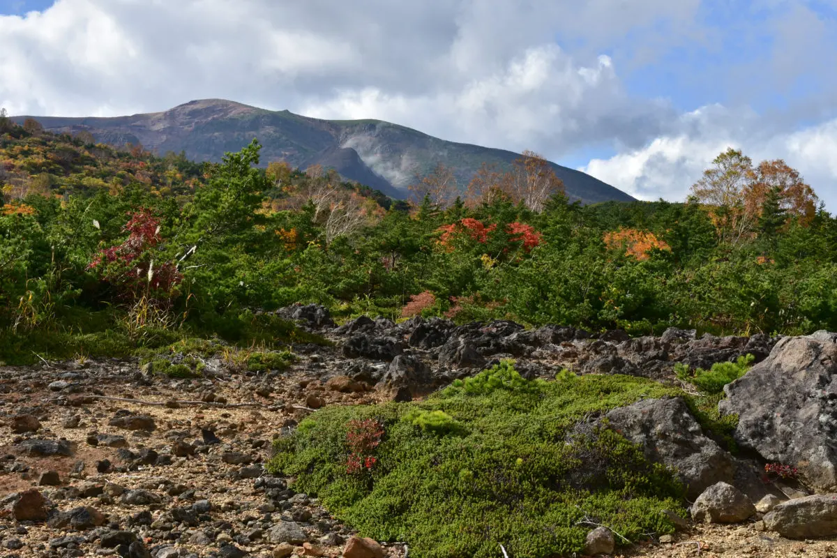
A giant red torii gate straddles the road on the outskirts of Togatta Onsen, marking the start of the ascent up Mount Zao. The road hits a 10% grade a few hundred meters later, and stays that for the next 11 kilometers or so. Minor spiritual sites, waterfalls, and the like are located at intervals along this steep section—each a good excuse to stop for a breather and some photos.
The grade eases to 7% or 8% as you approach the highest, most scenic portion of the Echo Line. The roadside vista points offer much better views than the road itself, so pull over when you see them. Be sure not to miss Komakusadaira, a landscape so spectacular it causes Tohoku natives to declare Miyagi-Zao the side with the superior scenery.
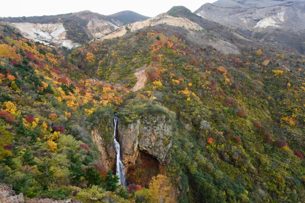
A short while later near the peak of the route, you’ll see a toll road on the right: the High Line, a 2.5-kilometer-long road leading to the Okama Crater. Unfortunately, cyclists are not permitted to use it outside of the annual Japan Zao Hill Climb Eco event. The stunning crater is a must-see though, so use an alternative means of access: hike up the trail from the base of the High Line or ride a chair lift up to the crater. The chair lift is located just on the other side of Togatta Pass, the high point of the ride.
After cresting Togatta Pass, it’s a fun winding descent down to Kaminoyama Onsen, a hot springs town with a convenient train station. Reward yourself with Japanese sweets at the venerable Dango Honpo Takahashi and a dip in one of the town’s many hot springs.
Last Update October 15, 2019
Area Mt. Zao
Details
ACCESS BY PUBLIC TRANSIT
Start from Shiroishi Station, end at Kaminoyama Onsen Station (or vice versa)
CLOSED DAYS
The Zao Echo Line is closed in winter due to heavy snow